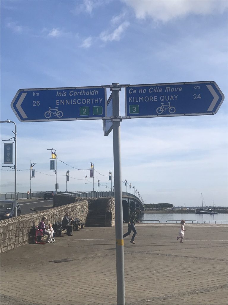
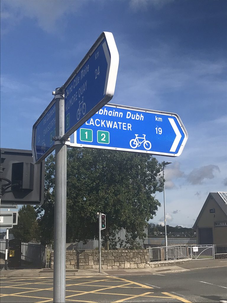
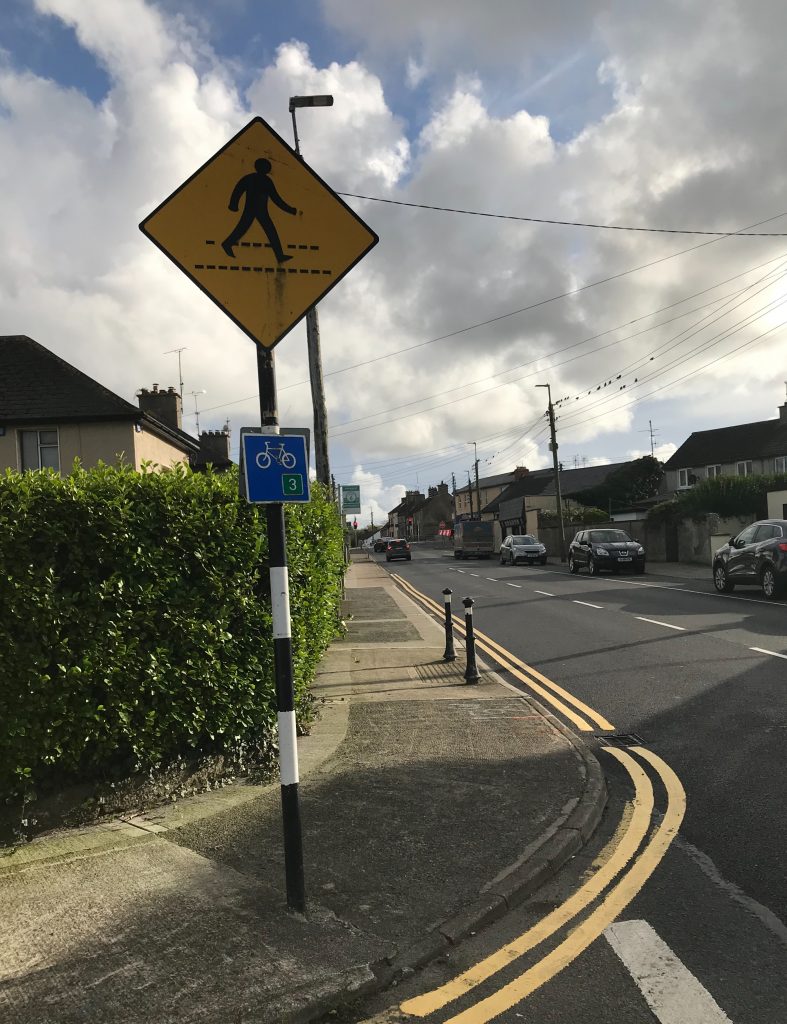
If you spend any amount of time cycling in Co. Wexford, you will have come across these ‘Discover Ireland’ cycling route signs.
I decided to take a closer look at route No. 3.
Here’s how I got on…
I was trying to view this as if I were a random newcomer to town who had stumbled upon this sign and wanted to check it out further.
The first thing that you notice is that there is no information whatsoever at this meeting point about the routes.
We have a magnificent county and an information board here should whet a rider’s appetite with what lies ahead; what surface one might expect, it’s degree of difficulty, how much traffic to expect, what sections are traffic free, whether it’s suitable for children, sightseeing highlights, historic highlights..
Does the cycle follow a particular theme?
Is it a challenging route that is aimed towards a sportive rider as the 9 stones cycle?
Without such notices, then what is the purpose of these?
Most cyclists will have a Garmin or smart phone where a random route can be uploaded.
What is the advantage of cycling one of these?
why would I as a tourist arriving in Wexford Town want to cycle this?
Maybe it’s to help a cyclist who may not be familiar with the area to not get lost by providing an easy to navigate ‘breadcrumb trail’?
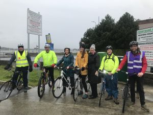
Setting out.
I set off down the Quay front on a beautiful morning with an open mind seeking adventure.
A couple of kms out and it was good to see this confirmation sign as I continued on the route on to the northbound Drinagh cycle path.
(More about this later)
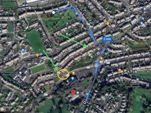
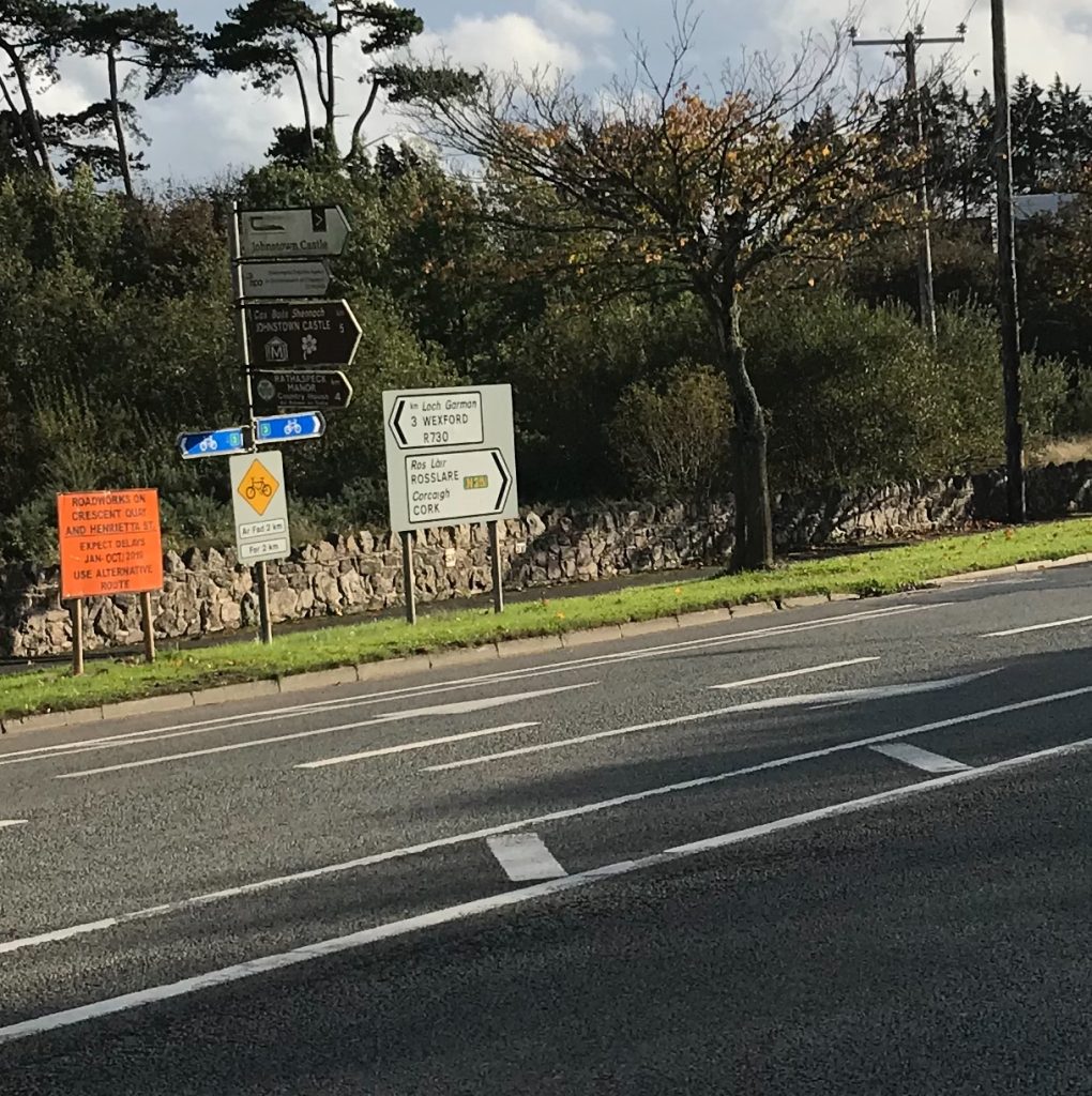
Continuing on what I believed, was the route (as I didn’t see any signage taking me away from heading straight on), I come across the first confusing sign of the bike ride.
One sign is telling me to continue straight, while the other seems to be suggesting that I take a right turn.
I have done many similar trails in France, Germany, Netherlands, Belgium etc. and they mostly follow a simplified ‘breadcrumb trail’ which takes this type of confusion out of the ride.
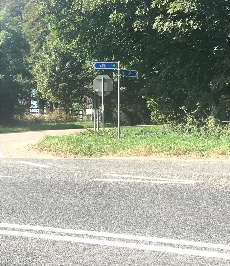
I decided to go straight on and was rewarded with another confirmation sign in Killinick.
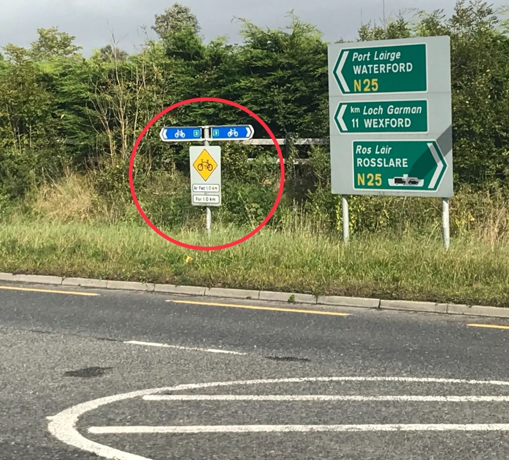
This road has a good safe hard shoulder and I arrived at the first major junction along the route, the Ashfield Cross Roundabout.
I was hoping for another sign here but alas it’s over to guess work again.
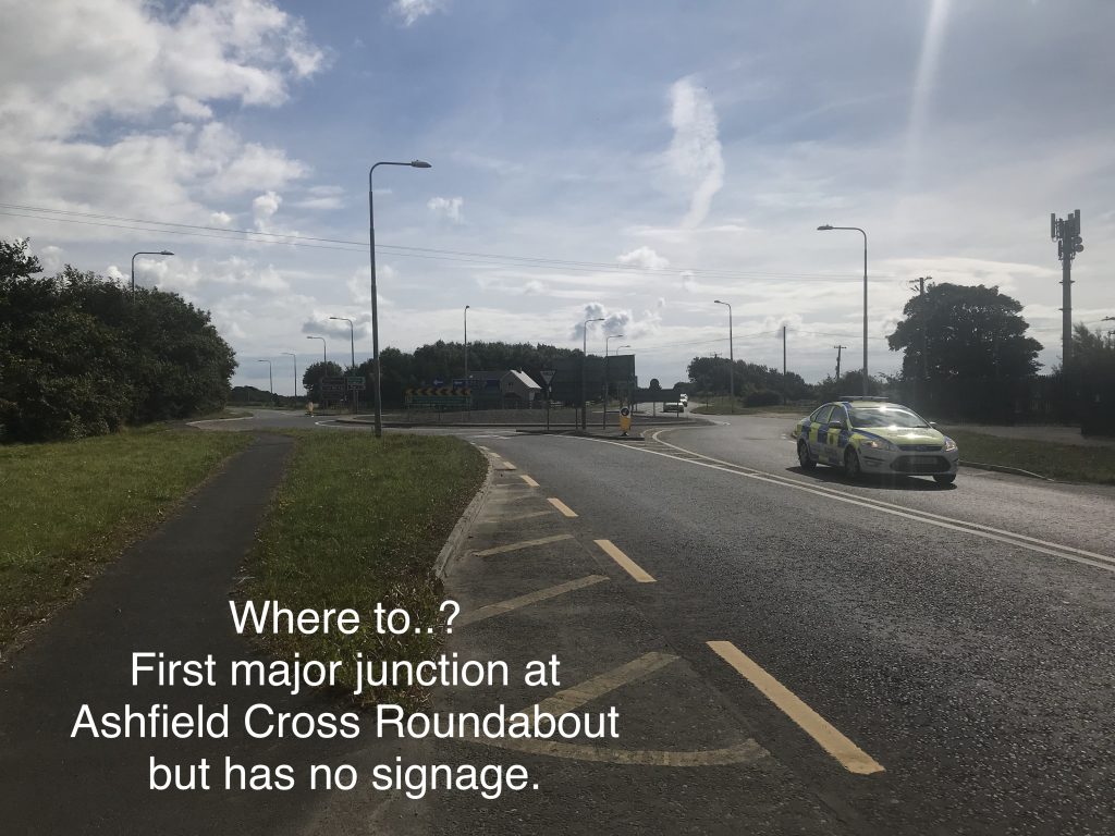
I take a guess at which way the route expects me to go, putting myself in the shoes of a frustrated strange and decide to head towards Rosslare Strand – wrong move.
I continued on down this lovely road for cycling on and don’t come across any other signage either along the way or at the roundabout leading to Rosslare Strand.
At that stage, I decided to abandon the route and continue on a route that I was more familiar with.
Where did I go wrong?
I decided to look up the route online when I got back..
The link that comes up from a google search for this is from discover Ireland.
It comes with a map and an explanation of the route.
However, on closer inspection, the map and the signage do not match up. The description of the route too contains an inaccuracy or two.
https://www.discoverireland.ie/Activities-Adventure/wexford-cycle-routes/78119
Aha…so this is the problem!
Looking closer at the map, and the wording below, there should have been a sign pointing a right turn towards Johnstown Castle.
Instead the sign in that location took the cyclist straight on.
This is a fairly important turn to make early on for the route and it’s difficult to see how it was omitted?
The route description is short and concise but there is no busy Ferryport in Kilrane.
Route 3: South Wexford Route (78 km; Approximately 5 hours)
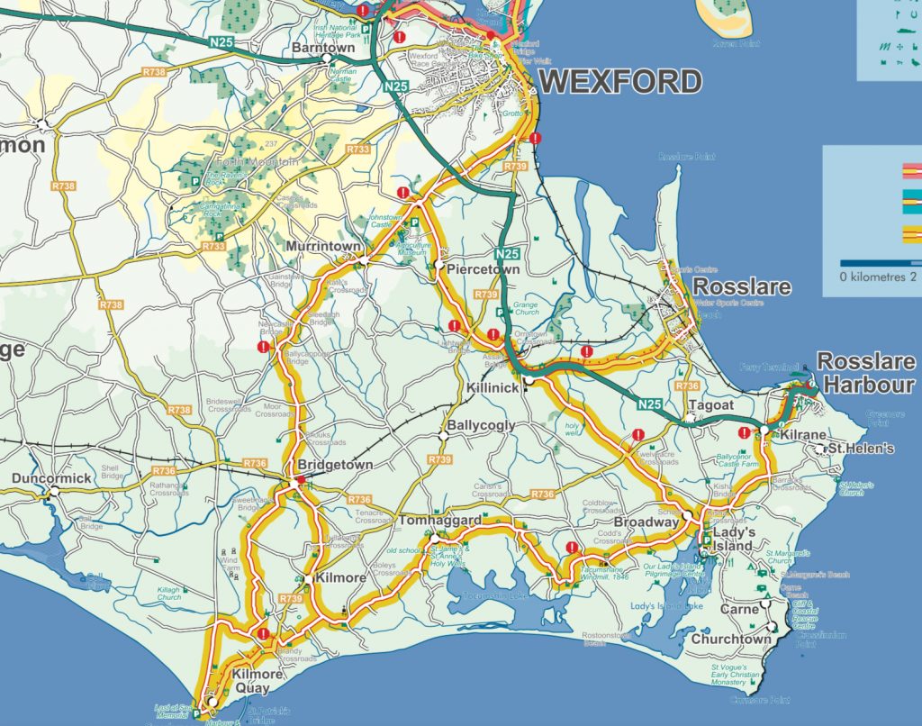
This is a tour of south Wexford which initially takes cyclists uphill towards a roundabout near the picturesque Johnstown Castle, and then on to the old town of Rosslare and its busy Ferryport nearby at Kilrane. There are several beaches signposted off the quiet roads between Kilrane and Ladies Island. The route to the fishing village of Kilmore Quay is fast, flat and characterised by sudden changes in direction but watch out for Irelands only surviving windmill at Tacumshane. Later cyclists can afford to linger at Johnstown Castle with its gardens and Agricultural Museum, knowing that a few minutes freewheeling will take them back down to Wexford town. Care is required on the N25, R740 and 739 as well as at many junctions along the way.
I hope to take a closer look at this route at a further time. I know quite a lot of it and it’s not bad.
The potential is certainly there.
There are several other routes that I could suggest in that area but given that these routes have been there for quite a while now, their road surfaces may not be up to scratch.
My suggestion though would be to move the start point of these cycle routes down the Quay front to the tourist office and include a notice there of what to expect of the route.
I’ve seen interconnecting routes such as these done differently and maybe we could get more out of them by following this Dutch model?
The signage for these routes are cyclist specific so I’m not convinced of their placement in a similar way that directions for cars are for this purpose.
Something more simplistic and minimalist at the side of the road at cyclist head height with clear directions and quick information on what to see works best.
This would also lessens the ‘opportunity’ of vandals changing the sign direction.
Eliminating right turns especially at busy sections would take some of the angst out of the route especially for less experienced riders – this is relatively easy to do with this route.
Areas can be created off the main loop in the guise of cycle hubs. These are on the route already but ideally these should be further loops linking in to the main loop rather than the more simplistic one road in, one road out model. Where a hub takes you off the main loop, that should be very obvious to the rider.
I rarely see cycle tourists on this route and maybe if we were to take a closer look and organise these properly, then towns and villages along these routes could benefit from the current boom in cyclo-tourism.
Leaving them the way they are is such a waste especially in times where local villages and towns are struggling.
We can do much better Wexford!